Residential Development for sale in Monks House Lane
LOCATION
** Land zoned for Residential Development extending to approximately 14.47 hectares (35.75 acres) being offered For Sale Freehold in Two Lots or as a Whole.**
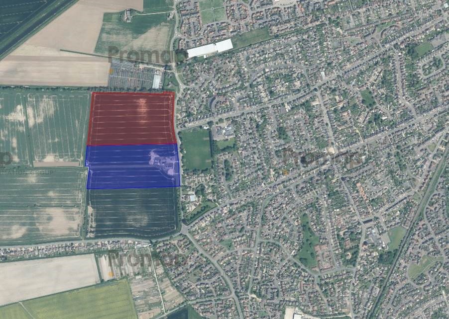
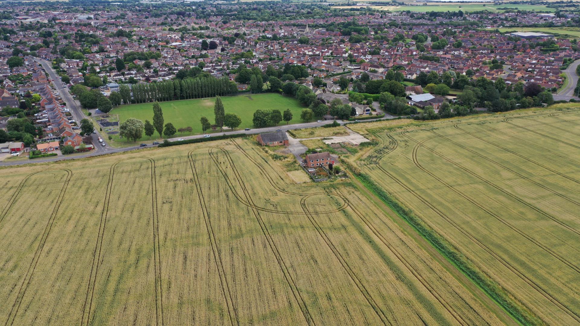
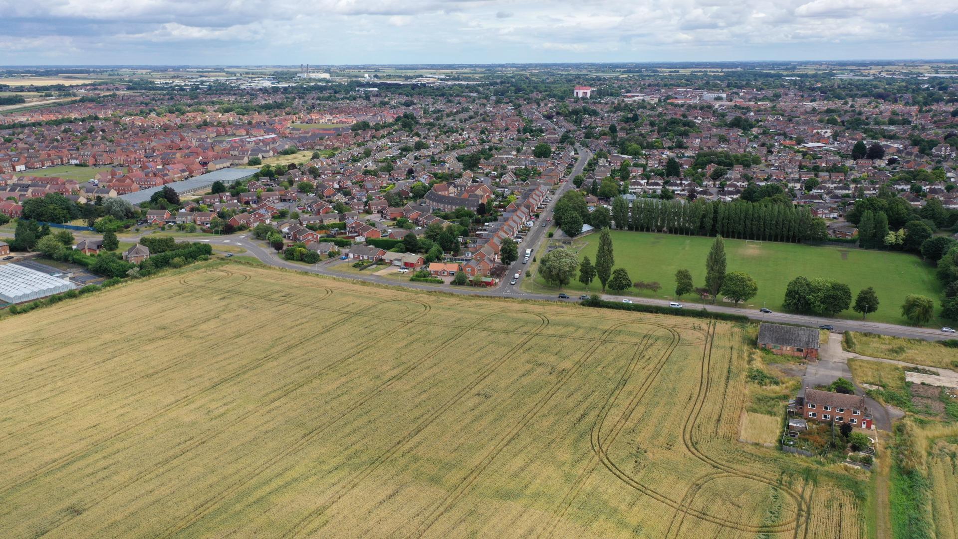
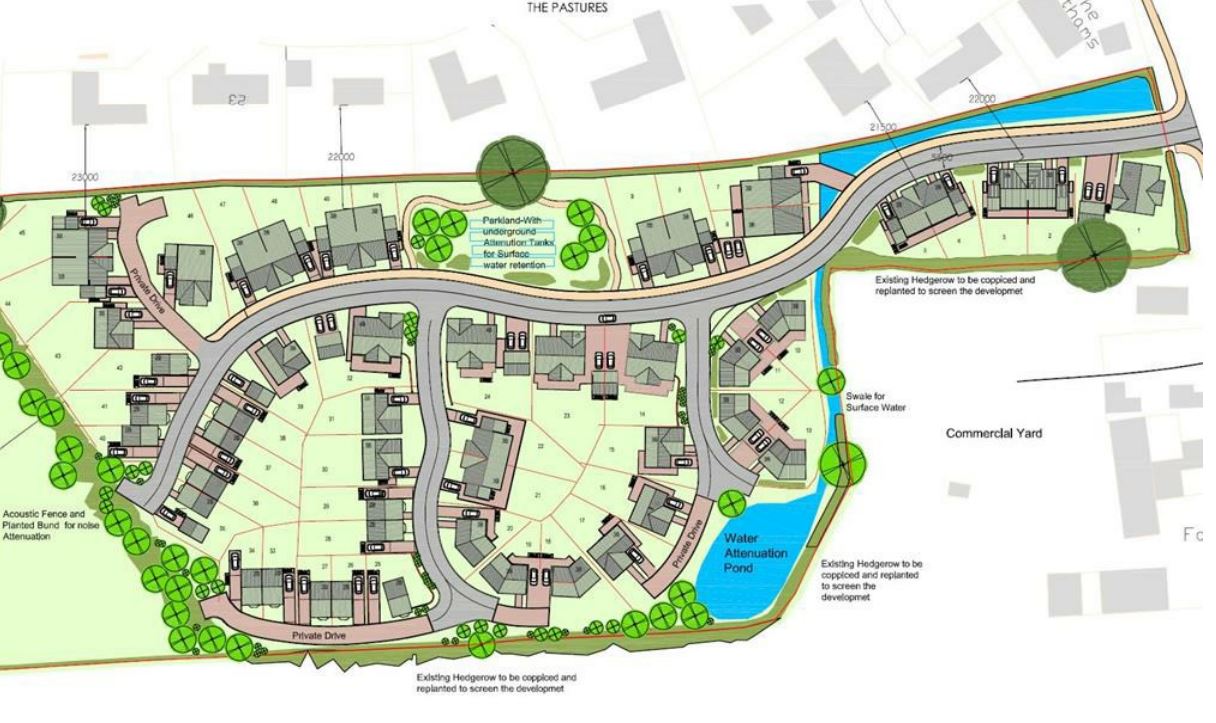
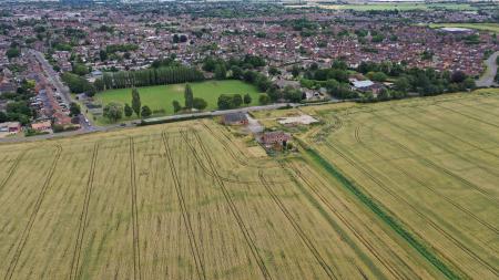
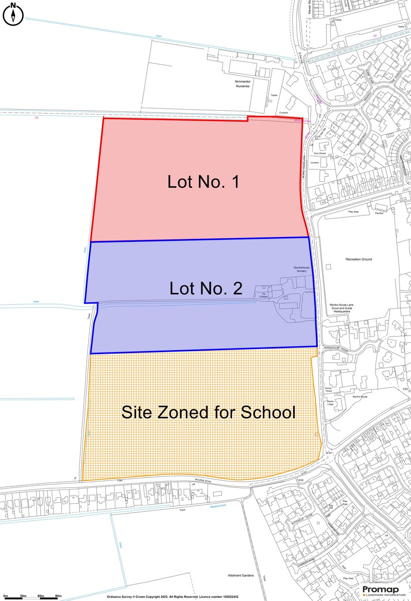
The property is situated on the west side of Spalding to the west of Monks House Lane to the north of Bourne Road. It is accessed directly off Monks House Lane. The market town of Spalding offers a significant range of services and amenities. The property is on the bus route for Spalding town centre. Spalding is within easy travelling distance to the City of Peterborough, some 19 miles to the south west. Peterborough has easy connections to the north and south on the A1 and the main East Coast rail connection is from Peterborough to London King’s Cross (minimum journey time approximately 45 minutes). Additional nearby market towns include Bourne, Grantham, Sleaford and Stamford are within easy reach. A general location plan and a site plan are included with these Particulars.
DESCRIPTION
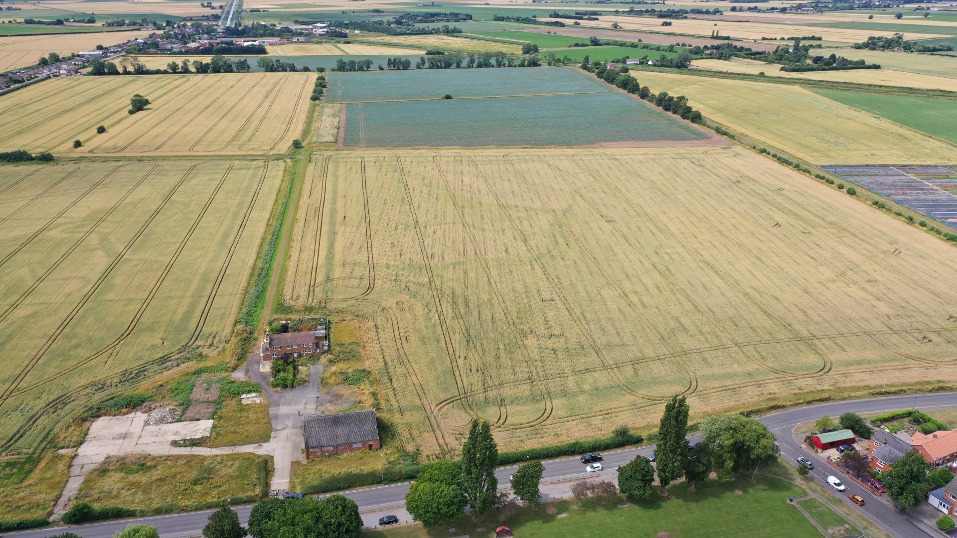
The land forms part of Monks House and Park Farm, situated on the west side of Spalding and comprises approximately 14.47 hectares (35.75 acres) in total, all situated to the west side of Monks House Lane and on the Spalding town centre side of the new proposed Spalding Western Relief Road, the northern most section of which is already under construction (Section 5). The property is being offered For Sale in two lots or as a whole.
ACCOMMODATION
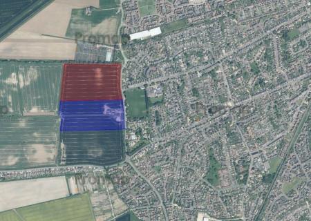
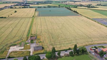
Lot No. 1: A total of approximately 7.235 hectares (17.875 acres) as shaded red on the attached plan, forming a proposed residential development site (subject to planning) with easy access onto Monks House Lane (subject to Highways approval). The land is bordered on the northern boundary by an Internal Drainage Board drain and the Internal Drainage Board have the benefit of their byelaw to access the drain. It is believed the drain is piped in part along this northern boundary. The western boundary is delineated by a field dyke and the southern boundary is an open boundary, being situated within the cropping area.
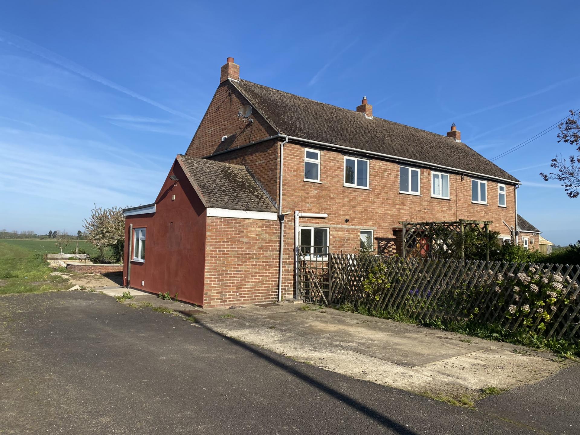
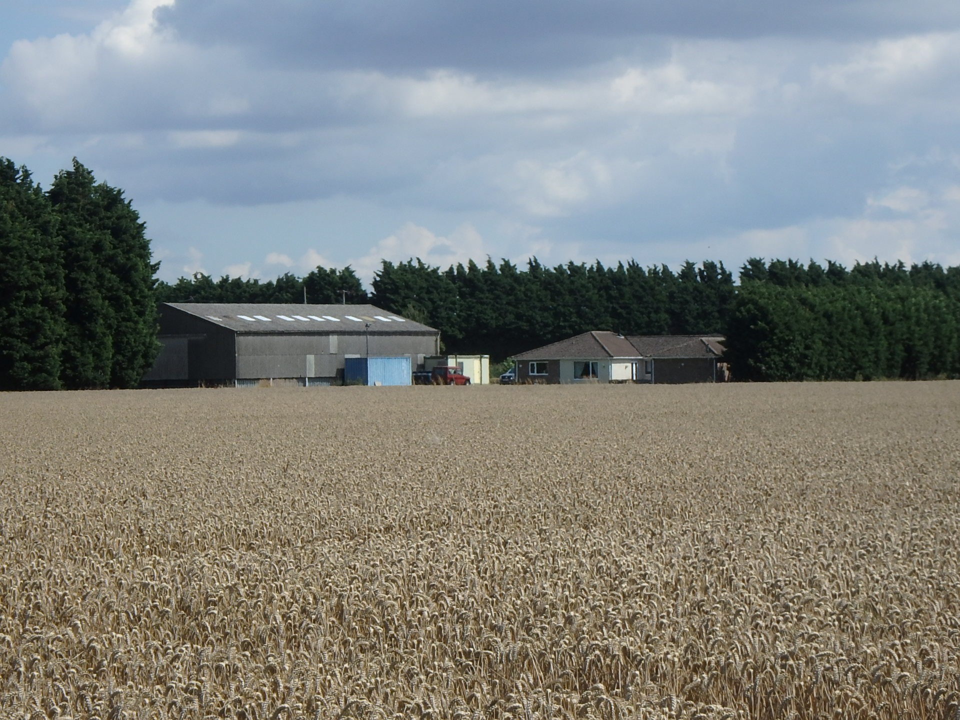
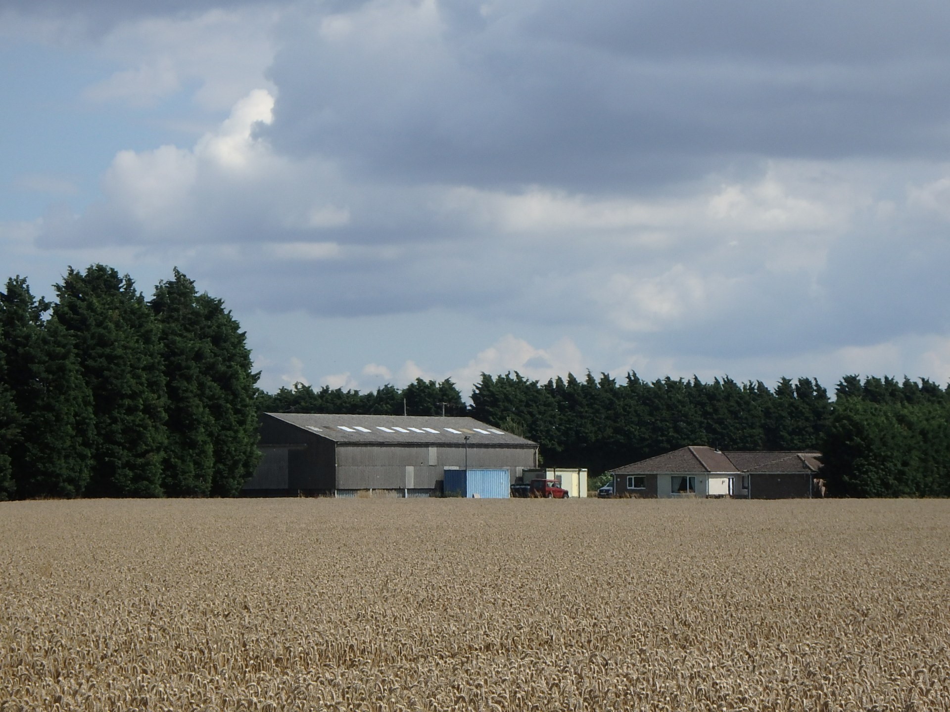
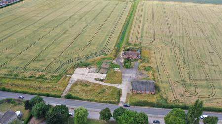
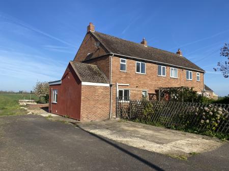
Lot No. 2: A total of approximately 7.235 hectares (17.875 acres) as shaded blue on the attached plan, forming a second proposed residential development site (subject to planning) and with access directly off Monks House Lane (subject to Highways approval). The norther boundary is an open boundary with Lot No. 1, the western boundary is delineated by the east brink of the dyke and additional marker posts are erected on this western boundary. The property comprises arable farming land and a yard area. Within the yard is a pair of semi-detached houses being Nos. 1 and 2 The Cottages together with a brick storage building.
The Cottages:
Of brick construction with tiled roof, UPVC double glazed windows, wooden external doors, additional single storey extensions, front tarmac drive with adjacent front garden area, rear gardens laid to lawn/mixed hard surfacing.
No. 1 The Cottages, Monks House Lane, Spalding PE11 3LH (the Northern Cottage):
Entrance through front door into hall: 3.68m x 1.81m (max) with stairs off.
Lounge: 2.74m x 3.96m (max):
Lounge/Diner: 4.0m x 3.97m (max): Fireplace with tile surround.
Kitchen: 1.79m (max) x 2.29m: With kitchen sink.
Pantry Cupboard: 0.58m x 1.80m:
Utility Room: 1.99m x 2.42m (max): With storage cupboard
WC: 0.75m x 1.19m: With high level WC
Rear door to timber lean-to porch area:
First floor landing: 1.76m x 2.29m (max) with loft hatch.
Bathroom: 1.68m x 1.72m: Shower cubicle, pedestal wash hand basin
Master Bedroom: 4.0m x 4.11m (max): Built in cupboard.
Bedroom 2: 2.78m x 4.12m (max): Airing cupboard with insulated hot
water tank, built in cupboard.
Bedroom 3: 2.70m x 2.42m: Over stairs cupboard.
No. 2 The Cottages, Monks House Lane, Spalding PE11 3LH (the Southern Cottage):
Entrance through front door into hall: 3.67m x 1.81m (max): With stairs off.
Lounge: 3.96m x 2.72m (max):
Lounge/Diner: 3.95m x 3.96m (max): Open fireplace in need of surround.
Kitchen Area: 2.99m x 1.79m
Extended Kitchen Area: 1.90m x 3.26m
Utility Room: 2.51m x 1.90m: With rear door.
First floor L Shaped Landing: 1.97m x 1.74m (max) plus 0.73m x 1.42m.
Bathroom: 1.86m x 3.06m: Tiled surround, bath with shower over, bidet
(the WC and wash hand basin have been removed).
Master Bedroom: 3.87m x 4.12m (max).
Bedroom 2: 2.68m x 2.75m (max): With built in wardrobe.
Bedroom 3: 2.69m x 2.46m (max).
Storage Building: Approx. 18.37m x 14.83m (gross internal measurements) Of brick construction with steel portal frame, corrugated asbestos roof over, double sliding doors to south side, divided with stud walling into three main rooms plus store room, office and two WCs, concrete floor, three phase and single phase electric supply.
There are a number of existing access points off Monks House Lane serving the yard, arable land and cottages.
SERVICES
Mains electricity, water, gas and drainage services are within the locality but it is recommended that all interested parties make their own enquiries as to the capacities and availability of connecting into such services together with all necessary costings thereof. Currently electricity and water are connected to the dwellings and building. These are also connected to private foul drainage facilities.
PLANNING
The land is zoned as Mon008 within the Local Development Plan for South East Lincolnshire which was adopted on 8th March 2019 and is proposed to run until 2036.
The wording from the adopted Local Plan document is as follows:
• The site is within Flood Zone 3a, and the SFRA identifies flood hazard in 2115 as ‘no hazard’ and flood depth in 2115 as zero. Development will be required to include appropriate mitigation.
• Waste water has sufficient capacity for this site.
• The foul sewerage network requires upgrading for this site.
• Sewers and water mains cross the site.
• Water supply network: infrastructure and/or treatment upgrades required to serve proposed growth or diversion of assets may be required.
• Foul sewerage network capacity: infrastructure and/or treatment upgrades required to serve proposed growth or diversion of assets may be required.
• The site lies within a significant Iron Age Romano British landscape and further information may be required.
• The site will be subject to financial contributions towards the funding of projects featured in the Spalding Transport Strategy in accordance with the provisions of policy 30: Delivering the Spalding Transport Strategy.
The land represents a prime opportunity to open up and create a significant residential development on the west side of Spalding and on the town side of the proposed Spalding Western Relief Road.
OTHER
TENURE
The tenure of the property is freehold and the land is registered at Land Registry forming part of
Title No. LL378382.
The land is subject to a Farm Business Tenancy in favour of C W Dobbs Limited.
Vacant possession of the cottages, yard and building is potentially available immediately and the arable land is available following the harvesting of the crops.
RIGHTS OF WAY AND EASEMENTS
The property is offered For Sale subject to any rights of way or easements whether known to exist or not. The Seller is not aware of any rights of way or easements crossing either lot with the exception of the Internal Drainage Board byelaws to access the drain on the north side of Lot 1 and to access any piped section of this drain along the northern boundary. An Anglian Water main runs along the eastern frontage of part of Lot 1 and the whole frontage of Lot 2. Further details are available upon request from the Selling Agent.
METHOD OF SALE - EXPRESSIONS OF INTEREST INVITED BY 12 NOON ON FRIDAY 10th NOVEMBER 2023
Expressions of Interest are invited, including indicative offers, in both lots and interested parties will be asked to put forward an indicative outline of their proposed plans for the site and their method of purchase being either an Option Agreement, Conditional Purchase or Unconditional Purchase with appropriate terms of offer for the owner’s consideration. Preference will be given to an outright unconditional sale.
The Seller owns adjoining farmland situated to the west side of the subject sites and also owns the site situated to the south of the subject land which is cross hatched in orange on the site plan within these Particulars. This orange site is zoned for a new secondary school to serve the west side of Spalding. If interested parties would like to discuss this site in addition to the sites primarily being offered, they are invited to make their interest known.
PHOTOGRAPHS
The photographs taken in these Sale Particulars were taken in April 2023. These Particulars were prepared in August 2023. The drone photographs were taken in July 2023.
DISPUTES
Should any disputes arise as to the boundaries or any points concerning the Particulars, Schedules and Plans, or the interpretation of any of them, the question will be referred to an Arbitrator appointed by the Selling Agent, whose decision acting as expert, shall be final. The buyer will be deemed to have full knowledge of all boundaries and neither the seller nor the selling agents, will be responsible for defining the boundaries or ownership thereof.
HEALTH AND SAFETY
Neither the seller nor the selling agents are responsible for the safety of those viewing the property and accordingly, those viewing the land do so at entirely at their own risk. Viewing is strictly by prior appointment with the Seller’s Agents.
These Particulars are issued subject to the property described not being sold, let, withdrawn or otherwise disposed of. These Particulars are believed to be correct but their accuracy cannot be guaranteed and they do not constitute an offer nor a contract. All references to areas should be checked/verified by interested parties.
VIEWING
The viewing of the property will be strictly by prior appointment with the Seller’s Agents.
R Longstaff & Co LLP, 5 New Road, Spalding, Lincolnshire PE11 1BS / Tel: 01775 766766 Option. 4 (The Agricultural Department) Email: rdl@longstaff.com
Property Ref: 58325_101505014789
Similar Properties
Tholomas Drove, Wisbech St Mary, PE13 4SN
Land | £2,750,000
* Hiptoft Farm* 279.822 Acres (113.24 Hectares) Arable Land* Farm Buildings* Detached 4 Bedroom Bungalow* For Sale as a...
4 Bedroom Not Specified | Guide Price £2,750,000
* Total Area of 279.822 Acres (113.24 Hectares)* Grade I Arable Land* Farm Buildings* Fully Refurbished 4 Bedroom Bungal...
Land, Main Road, Long Bennington, NG23 5EH
Residential Development | £2,500,000
** METHOD OF SALE : The site is offered for sale by way of informal tender. Detailed offers are invited for the freehold...
Land - Wainfleet Road, Boston PE21 9RW
Residential Development | Guide Price £3,500,000
** Approximately 23.72 Acres (9.6 Hectares) with Outline Consent - Very Convenient High Profile Position on the Northern...
Residential Development Land - Boston
Not Specified | POA
• Approximately 23.72 Acres (9.6 Hectares) with Outline Consent• Very Convenient High Profile Position on the Northern O...
Washway Road, Fleet, Hollbeach PE12 8LT
Distribution Warehouse | £4,750,000
• Distribution Centre - Buildings area approximately 9,872 m² (106,264 sq. ft)• Site area approximately 7.57 acres (3.06...

Longstaff (Spalding)
5 New Road, Spalding, Lincolnshire, PE11 1BS
How much is your home worth?
Use our short form to request a valuation of your property.
Request a Valuation
